Barahona (Barahona)
Barahona, also known as Santa Cruz de Barahona, is the main city of the Barahona Province, in the southwest of the Dominican Republic. It has one of the most active ports in the region, as well as many ecotourism attractions. The city is a centre of sugar production and industry. Barahona is also known for being the only place where the rare Larimar stone can found.
Before its discovery by Europeans, the area belonged to the Native Taino chiefdom of Jaragua, ruled by Bohechío. The current name of the province and city is derived from the surname of the first Spaniards who came to the area, some of these Spaniards were also from the town of Baraona in Spain and named it in honor of their town of origin. The Spaniards spread throughout the territory and designated places with their names. Francisco de Barahona, Gabriel Barahona, Luis de Barahona and Juan de Barahona arrived on the first and second voyages of Christopher Columbus in the 1490s. After the nation's independence in 1844, Barahona was a military post of the Azua Province. In 1858, Barahona was elevated to the category of municipality. When the province was created in 1881, Barahona was made its head municipality. In 1907, the territorial denominations of cantons and maritime districts were abolished and replaced by the terms communes and provinces, respectively, while Barahona was promoted to this category the same year.
The revolutionary movement known as "El Salvador" was founded in Barahona by Cuban radicals with the purpose of mobilizing financial resources to support the independence movement in Cuba from Spain. Dominican president Ulises Heureaux provided money and weapons to Cuban patriots and from the shores of Barahona, weapons were brought to Cuba.
Between 1916 and 1924, the American presence in the province influenced the planting of cane and the construction of the hacienda. In 1927, the first aviation company of the Caribbean region was started in Barahona. The service was inaugurated between the cities of Barahona, Santa Cruz, San Juan, Puerto Rico, Santo Domingo and Port-au-Prince Haiti.
Map - Barahona (Barahona)
Map
Country - Dominican_Republic
 |
 |
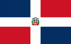
| Flag of the Dominican Republic | |
The native Taíno people had inhabited Hispaniola before the arrival of Europeans, dividing it into five chiefdoms. They had constructed an advanced farming and hunting society, and were in the process of becoming an organized civilization. The Taínos also inhabited Cuba, Jamaica, Puerto Rico, and the Bahamas. The Genoese mariner Christopher Columbus explored and claimed the island for Castile, landing there on his first voyage in 1492. The colony of Santo Domingo became the site of the first permanent European settlement in the Americas and the first seat of Spanish colonial rule in the New World. It would also become the site to introduce importations of enslaved Africans to the Americas. In 1697, Spain recognized French dominion over the western third of the island, which became the independent state of Haiti in 1804.
Currency / Language
| ISO | Currency | Symbol | Significant figures |
|---|---|---|---|
| DOP | Dominican peso | $ | 2 |
| ISO | Language |
|---|---|
| ES | Spanish language |


